Sawtooth Area, central Idaho
researched by Glenn Davis - last updated September 2, 2000
The Sawtooth area consists of the Sawtooth Mountains on the west, and
the White Cloud and Boulder Mountains on the east. These are separated
by a Sawtooth Valley, geologically a graben, through which Highway
75 runs. The town of Stanley is north of the north end of this valley.
The Forest Service has a low-res MAP.
Wilderness Fees: There is a fee for parking at trailheads.
It's $5 for 3 days, and $15 for a year. If you have a Golden Eagle
Pass, it's free.
Here is trail
status information. On July 12 we read: "Cramer Divide:
Trail mostly covered in snow." We must watch these reports.
It seems that the ranges on the east have less snow.
See also:
Sawtooth National Forest Home Page
and
another Sawtooth National Forest Home Page
and
campground list.
Sawtooth Wilderness
This area is west of highway 75. It contains the Sawtooth Mountain
range. The highest peak is about 10,700. The rock is granite.
It is jagged, so climbing any peaks, or traveling cross-country, look unlikely.
My guidebook is not a climbing guide, so this opinion may be too pessimistic.
The Sawtooth Wilderness mostly trends north-south with the steepest
side on the east, just like the Sierra. Most of the of the trailheads
are on the east side, and very close to the town of Stanley. Here
is a list of trailheads worthy of consideration, starting on the north
and going clockwise:
| Trailhead |
elevation |
notes |
| Stanley Lake |
6513
|
north side |
| Iron Creek |
6710
|
east side |
| Redfish Lake |
6547
|
east side |
| Hell Roaring, lower |
6780
|
east side |
| Hell Roaring, upper |
7200
|
east side, 4 miles of dirt road are required to reach it |
| Pettit Lake |
6996
|
east side |
| Grandjean |
5106
|
west side |
Here are some possible trips:
| starting TH |
ending TH |
foot miles |
car miles |
high point |
notes |
| Redfish Lake |
Hell Roaring, upper |
30.6
|
15.4
|
9500
|
passes Hell Roaring Lake, the lake below Finger of Fate is a side trip
of about 1 mile from here |
| Redfish Lake |
Pettit Lake |
33.9
|
15.8
|
9500
|
intersects most of the previous trip (about 20 miles of it), does not
go close to Finger of Fate |
| Iron Creek |
Redfish Lake |
31.0
|
11.8
|
9400
|
passes Sawtooth Lake which is a popular area |
| Stanley Lake |
Redfish Lake |
37.0
|
14.5
|
9400
|
passes Sawtooth Lake which is a popular area |
| Grandjean |
Stanley Lake |
20.3
|
41.6
|
9000
|
it is possible to reach the Sawtooth Lake and return to Grandjean by
a different root, thus making a loop starting and ending at Grandjean |
White Cloud and Boulder Mountains
These ranges are east of highway 75. The highest peak
is Castle Peak at 11,800 feet. The rock is limestone. From
the photographs in the book, it is not as jagged as the Sawthooth granite.
Climbing peaks, or traveling cross-country, might be possible. Most
of the trails and nice lakes are on the east side.
I see only 2 worthwhile trailheads:
| Trailhead |
elevation |
notes |
| Fourth of July Creek TH |
8900
|
west side, 10.1 miles of gravel road, #14 on the map. |
| Livingston Mill |
7221
|
east side, 4.8 miles of dirt road, it is called Boulder Creek #13 on
the map. |
Here are some possible trips:
| starting TH |
ending TH |
foot miles |
car miles |
high point |
notes |
| Fourth of July Creek |
Livingston Mill |
24.1
|
78.5
|
10,280
|
cross-country route over pass to Four Lakes basin. May have snow
cornices until mid-August. Some cross-country after that. Side-trips
possible. lots of car travel. |
| Fourth of July Creek |
Livingston Mill |
24.8
|
78.5
|
10,000
|
trail route over Castle Divide, passes by Castle Peak,
some side trips possible |
| Livingston Mill |
Livingston Mill |
14.2
|
0.0
|
9868
|
not a loop trip, hike up to Big Boulder Lakes Basin, past Walker Lake,
then to Sapphire Lake and return. Many side trips to other lengths
are possible, plus some peaks. |
| Livingston Mill |
Livingston Mill |
23.8
|
0.0
|
9516
|
not a loop trip, hike up to Chain Lakes Basin, psst Willow Lake, then
to Hummock Lake and return. Many side trips to other lengths are
possible, plus some peaks |
| Livingston Mill |
Livingston Mill |
36.0
|
0.0
|
9868
|
combination of 2 previous trips, visiting both lake basins. This
one may be too long. |
Trip Photos
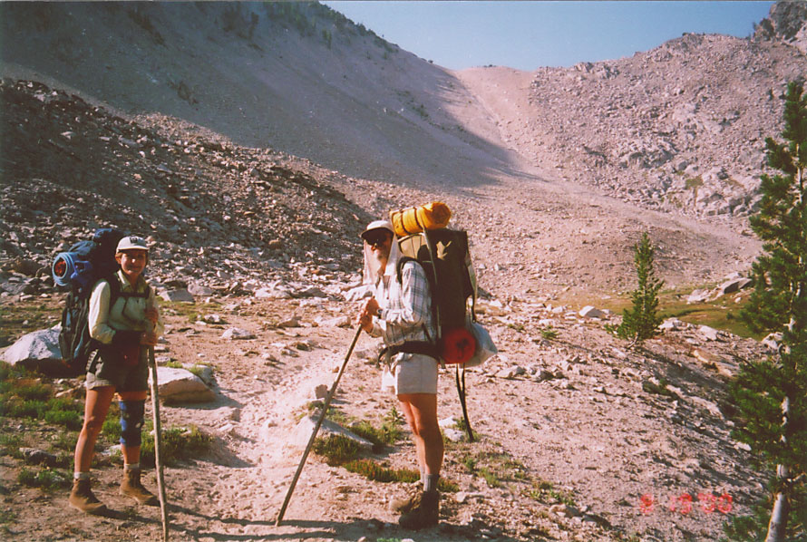
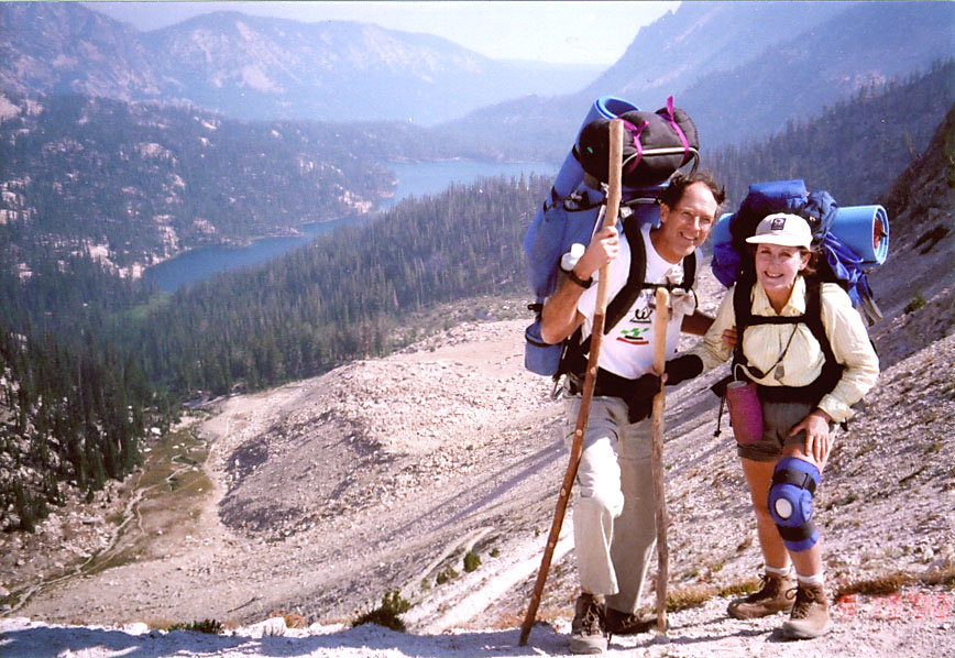
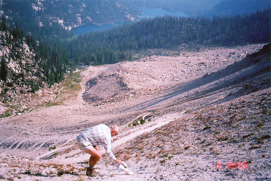
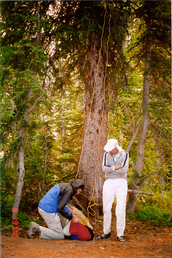
Sid, Loretta, and I decided to do Hell Roaring, lower to Redfish Lake.
The total mileage was 29 miles. We camped 5 nights at these 5 lakes:
Hell Roaring Lake,
Imogene Lake, Edna Lake, Hidden Lake, and Middle Cramer Lake.
These photos were taken by Sid+Loretta:
| thumbnail |
description |
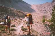 |
Loretta and Glenn below Imogene Divide,
to which we are about to hike
MAP |
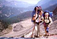 |
Sid and Loretta from Imogene Divide, with Imogene Lake,
where we camped the previous night, in the background |
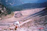 |
Glenn at Imogene Divide, recovering his hat |
|
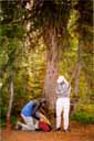
Sid and Glenn hanging food at Edna Lake
MAP |
 |
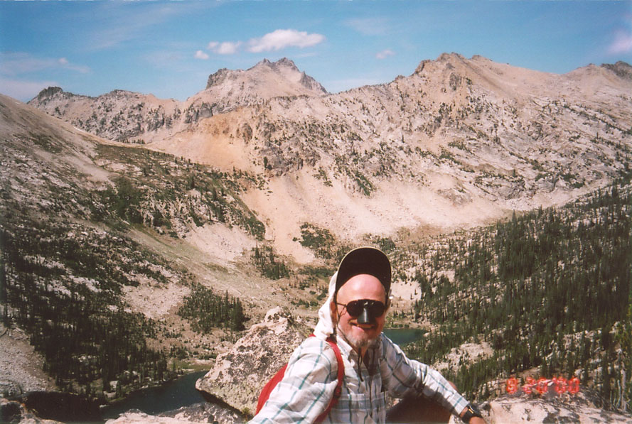
Glenn from Payette Peak (10,211 feet), with Hidden Lake in background.
High peak in background is probably Elk Peak (10,582 feet).
Photo by Sid.
MAP |